Capital Edition Of A Complete Map (Of The World Based On) Astronomy
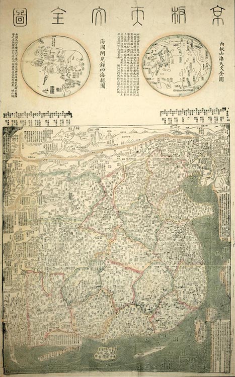
The Jingban tianwen quantu reflects a Sinocentric world view in which every country but China is relegated to the periphery. At the top is a panel with two side-by-side hemispheric world maps. Korea and the islands of the east Indies are illustrated to the east and south of the China land mass, while a shrunken Europe is squeezed into the upper left corner.
It is a woodblock map on rice paper, and it features outline color with a green sea. In two places the image is interrupted by a thin band of white space, dividing the map into thirds.
Click here to go to an enlarged interactive zoom and pan version of the map. The interface allows users to zoom in on details or zoom out to get a view of the entire map.
Click on the navigation on the right to learn more.
Credits
Richard J. Smith, Dara Flinn