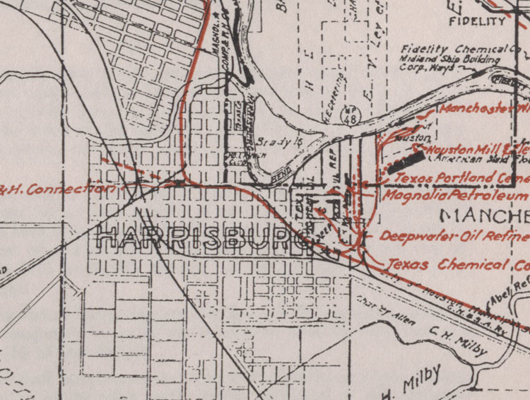
Harrisburg portion of larger map "Port Terminal Railroad Association map of track owned by the Harris County Houston Ship Channel Navigation District and track owned by private industry"
Dublin Core
Title
Harrisburg portion of larger map "Port Terminal Railroad Association map of track owned by the Harris County Houston Ship Channel Navigation District and track owned by private industry"
Description
black and white map of the Houston Ship Channel with Port of Houston railroad track marked in red
Creator
Port of Houston Authority
Source
J. Russell Wait Port of Houston Papers , MS 346, Box 21, folder 4, item 2, Exhibit A, Woodson Research Center, Fondren Library, Rice University
Publisher
Rice University
Date
1943
Rights
This work is licensed under a Creative Commons attribution 3.0 License. This digital pubication is available courtesy of Rice University. Contact Woodson Research Center at Rice University with any questions, woodson@rice.edu.
Format
Map
Type
image
Identifier
wrc00200
Is Part Of
Houston Waterways collections online at https://scholarship.rice.edu/handle/1911/36090 and http://digital.houstonlibrary.org/ (search "waterways").
Has Version
View full map online at http://scholarship.rice.edu/handle/1911/36103.
Collection
Citation
Port of Houston Authority, “Harrisburg portion of larger map "Port Terminal Railroad Association map of track owned by the Harris County Houston Ship Channel Navigation District and track owned by private industry",” Houston Waterways, accessed May 18, 2024, https://digitalprojects.rice.edu/wrc/waterways/items/show/1323.

