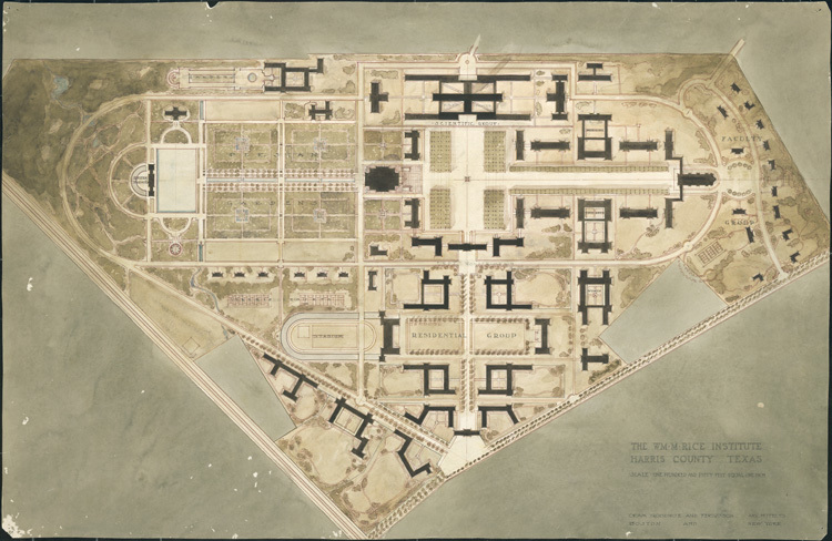
William M. Rice institute, map/aerial view of campus
Dublin Core
Title
William M. Rice institute, map/aerial view of campus
Subject
Rice University--Aerial views
William M. Rice Institute
William M. Rice Institute
Description
Map of the campus of the William Marsh Rice Institute, drawing by the architectural firm Cram, Goodhue, and Ferguson (William Ward Watkin - supervising architect)
Creator
Cram, Goodhue, and Ferguson
Source
Forms part of William Ward Watkin Collection, MS 352, map drawer 9, Woodson Research Center, Fondren Library, Rice University
Publisher
Digital version published by Woodson Research Center, Fondren Library, Rice University, courtesy of Houston Metropolitan Research Center
Date
no date
Rights
This material is in the public domain and may be freely used.
Relation
Forms part of William Ward Watkin papers, Series II. Architectural Career, 1910-1952., Rice Institute, Architectural Drawings and Prints.
Format
Architectural drawings
Language
eng
Type
image
Identifier
wrc01296
License
This work is licensed under a Creative Commons-Attribution-NonCommercial-ShareAlike 3.0 Unported License http://creativecommons.org/licenses/by-nc-sa/3.0/
Extent
175 KB
Has Version
View full digital object online, including a full zoom-and-pan jp2 version of the image, at http://scholarship.rice.edu/handle/1911/12695
Citation
Cram, Goodhue, and Ferguson, “William M. Rice institute, map/aerial view of campus,” William Ward Watkin, accessed May 5, 2024, https://digitalprojects.rice.edu/wrc/watkin/items/show/1351.

