History of the Jingban tianwen quantu

by Richard J. Smith, Rice University
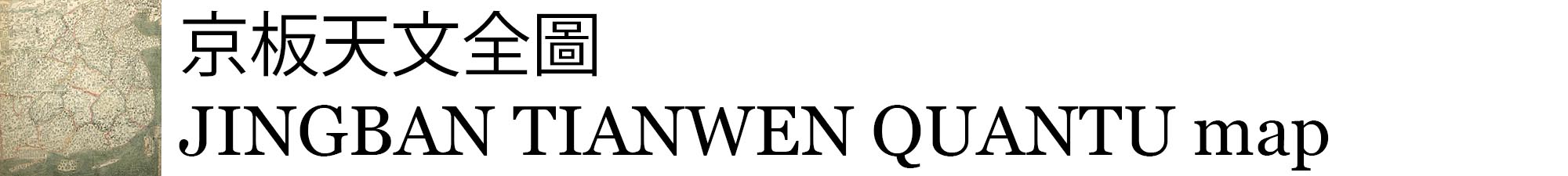
The Jingban tianwen quantu was produced in the 1780s or early 90s by a Chinese scholar named Ma Junliang, who received the prestigious jinshi civil service examination degree in 1761. He was well-known for his skill as a mapmaker.
Ma's map offers three different renderings of "the world"--one based on the model of Liang Zhou's Qiankun wanguo quantu gujin renwu shiji (Universal Map of the Myriad Countries of the Wor ld, with Traces of Human Events, Past and Present; c. 1600), another (upper right) derived from a loose rendering of Matteo Ricci's mappamundi that appears in the Ming encyclopedia Sancai tuhui ("Illustrated Compendium of the Three Powers"; c. 1607), and yet another (upper left) borrowed from a similarly structured Chinese map of the eastern hemisphere, first published by Chen Lunjiong in his Haiguo wenjian lu (Record of Things Heard and Seen in the Maritime Countries; 1730).
Ma's production may be considered an innovative offshoot of a genre of "complete maps of all under Heaven" (Tianxia quantu) that arose in the late seventeenth century and seems to have dominated Chinese visual representations of "the world" until at least the mid-nineteenth century. Different editions of these attractive, often delicately tinted maps were produced by a series of Qing scholars, including Ma, at least two predecessors--Yan Yong (fl. c. 1710) and Huang Qianren (fl. c. 1770)--and at least one successor, Zhu Xiling (fl. c. 1820). Of these individuals, only Yan is known to have employed a grid system, following the lead of the great Qing scholar, Huang Zongxi, who produced a rather stark "map of China" (Zhongguo ditu) in 1673.
Most maps of this variety go by the title Da Qing yitong tianxia quantu (Complete Map of the Comprehensive Great Qing Empire) or a close equivalent. Some, however, bear significantly different names as a way of highlighting certain additions to the basic cartographic format. For example, in addition to Ma Junliang's Jingban tianwen quantu we find an anonymous work titled Jingban tiandi quantu(Capital Edition of a Complete Map of Heaven and Earth), which includes a round star chart above the standard terrestrial image. There are also certain minor differences in quality, color, commentaries and a few place names in Tianxia maps.
Some discrepancies appear to be simple scribal mistakes, such as writing "ten thousand li" instead of "twenty thousand li" (the usual figure) for the extent of the Russian empire. Others involve the expansion or contraction of information--the inclusion or omission of a certain source of authority, or varying degrees of specificity regarding time periods and other minor details. Once in a while there is a major discrepancy. For instance, on some maps the characters "Small Western Ocean" appear where the characters "Great Western Ocean" would be expected. Occasionally, delicate coloring gives way to much darker and less attractive tones. On the whole, however, the similarities are far more striking than the differences.
Like virtually all large-scale Chinese maps, works of the Tianxia quantu genre convey a vivid sense of China's vast and varied landscape: its mountain ranges, overland travel routes, river systems, lakes, coastal communications, and deserts (particularly the Gobi), as well as other prominent landmarks--notably the Great Wall and the "Sea of Constellations" (Xingxu hai)--the legendary source of the Yellow River. An intriguing feature of almost every Tianxia map is a prominent stone tablet (bei) erected to Zhuge Liang in the far southwest, presumably out of appreciation for his role in pacifying China's borders during the Three Kingdoms period (222-265). This is the only example of an individual so honored in these maps; even the birthplace of Confucius at Qufu has only a general reference to the Kong family graveyard (Konglin), not a specific tablet.
Maps of the Tianxia quantu variety pay close and careful attention to administrative changes within China's provincial boundaries--changes resulting from divisions, consolidations and other adjustments. All maps of this sort employ sets of eight or so cartographic symbols to indicate important administrative centers such as provincial capitals (sheng), prefectures (fu), departments (zhou), districts (xian), passes (guan), garrison towns (yingzhen) and so forth. They also mark the presence of local headmen (tusi)--members of ethnic minorities responsible for supervising their own people and for reporting periodically on them to regular Qing officials.
Of particular importance to the authors of Tianxia maps are changes in the size and shape of the Chinese empire occasioned by Qing military conquests during the seventeenth and eighteenth centuries. The introduction to every new edition of these maps begins with exactly the same proud phrase: "The land ruled by the present dynasty is unprecedented in its extent." Each cartographer then proceeds to describe the specific political and military developments that made a new map necessary. For the most part, these developments had to do with campaigns by either the Kangxi or the Qianlong emperor which brought large areas of the Inner Asian frontier under direct Qing control. But they also involved negotiations between the Chinese and representatives of various "outer" peoples, from Tibetans to Europeans.
Significantly, "outer" areas are not at all well defined in maps of the Tianxia quantu genre. Representationally speaking, there are no obvious borders separating China from Russia or clearly delineating the individual kingdoms and territories of, say, Central Asia, India, or mainland Southeast Asia. In a few cases boundaries are suggested by written inscriptions; but only the oceans and seas allow certain countries to appear fully detached from the Central Kingdom. On three sides of the mainland such places are represented as islands, with written descriptions of varying lengths. There is no effort to show the relative size of foreign realms pictorially, however. Rather, the size of foreign territories often appears to be a function of the amount of text deemed necessary to tell the viewer what needs to be known about them. Most inscriptions provide useful historical background on the "barbarians" in question, including place-name changes and changes in their relationship to China over time. Sometimes they also supply data on distances, including travel routes and the length of an occasional border.
All works of the Tianxia quantu genre--and indeed all large-scale maps that deal with "barbarians" of any sort--refer to the Chinese tributary system. Some include textual information on the background and evolution of important Sino- foreign tributary relationships, the frequency of certain missions, and major tributary routes. In so doing they reveal a rich lexicon of tributary terminology. The preface to each map refers explicitly to the process by which barbarian envoys come to China and offer themselves as vassals of the Qing dynasty. This process of symbolic submission is always described as an arduous one, involving "the scaling [of mountains], the sailing [of seas], and several stages of translation [ti hang chongyi]."
Although some cartographers working in the Tianxia quantu tradition seem relatively unconcerned with representing foreign lands and peoples accurately, not all were. In a lengthy introduction to his map of 1714, Yan Yong candidly admits that limitations of both information and cartographic space prevent him from showing the actual locations of far away places. Nonetheless, he has tried to indicate their relative positions and to include textual information on their approximate distance from China. Although most later maps of the Tianxia quantu genre do not bother to make this point or to offer systematic data on distances, Ma Junliang's Jingban tianwen quantuoffers an interesting approach to the problem. By combining two radically different types of maps in one document, he gives his viewers an epistemological choice. Rather than trying to reconcil the two versions, Ma leaves the issue open--a cartographic compromise reminiscent of a Song dynasty stelebearing two radically different maps of 1136, one basically "mathematical" and the other fundamentally "cultural."
For further discussion, see Richard J. Smith, Chinese Maps: Images of All under Heaven (Oxford University Press, 1996) and Richard J. Smith, "Mapping China's World: Cultural Cartography in Late Imperial Times," in Yeh Wen-hsin, ed., Landscape, Culture and Power in Chinese Society (University of California, Berkeley, Center for East Asian Studies, 1998).
Here are a few other useful references on Chinese cartography:
- Cao Wanru, et. al., eds., Zhongguo gudai ditu ji (A Collection of Ancient Chinese Maps), Vol. 1, Warring States-Yuan Dynasty (Beijing, 1990), Vol. 2, Ming Dynasty (Beijing, 1994), and Vol. 3 (Beijing, 1997).
- Fuchs, Walter, "Materialen zur Kartographie der Mandju-Zeit," part 1, Monumenta Serica 1 (1935-36) and part 2 (1938); Der Jesuiten-Atlas der Kanghsi-Zeit. 2 vols. (Peiping, 1943); and The 'Mongol Atlas' of China by Chu Ssu-pen, and the 'Kuang Yu T'u' (Peiping, 1946).
- Harley, J. B., and David Woodward, eds., The History of Cartography, vol. 2 book 2, Cartography in the Traditional East and Southeast Asian Societies (Chicago, 1994).